VOLUMON Reality
Captured
Request quote

We scan buildings and places, and turn them into 3D walkthroughs, measurements and building models.

VOLUMON delivers 3D Gaussian Splatting, point cloud processing and Scan-to-BIM services for architecture, industry, infrastructure and heritage across the European Union.

  • 30+EU projects
  • 8Countries served
  • 5000m² / day capture

Three services. Choose by what you need the result for.

All three start with a scan of your site. They differ in what you receive at the end, and they can be combined.

3D Gaussian Splatting Show a place online

A photorealistic 3D copy of a place that anyone can explore in a web browser, with no special software or headset.

What you receive

A link to an interactive 3D scene that you can share or embed on your website, or files for game engines and VR.

Typical uses

  • Game development
  • Real estate & hospitality
  • Film & VFX
  • Digital twins
  • Heritage & museums
  • Marketing & web
See examples

Point Cloud Processing Measure a site precisely

Millions of measured points that record the exact shape and size of a building or site. It is the accurate base for drawings, surveys and calculations.

What you receive

A clean 3D dataset for your design or survey software, plus drawings taken from it: sections, elevations and contours.

Typical uses

  • As-built documentation
  • Volume & quantity surveys
  • Industrial & plant layouts
  • Infrastructure & survey
  • Deformation monitoring
  • Topographic & site surveys
See examples

Scan-to-BIM Plan a renovation or permit

A smart 3D model of an existing building, made from the scan. Walls, floors, structure and building services are separate objects with their own data, ready for design work, permits and facility management.

What you receive

A BIM model in Revit, ArchiCAD or IFC, detailed to the level your project needs.

Typical uses

  • Renovation & retrofit
  • Permits & EU compliance
  • Heritage HBIM
  • Clash detection
  • MEP & structural BIM
  • Facility & asset management
EU
Now an EU compliance topic

EU Directives — including the EPBD recast and national digital construction mandates rolling out across member states — increasingly require BIM-based documentation for public works, energy performance reporting, and renovation permits. As-built BIM from scan data is the fastest route to compliance for existing assets.

See examples

How we work

From your first message to the final files, in five steps.

Your step Our step

  1. 1

    You send a request

    Tell us where the site is and what you want to use the result for. The form below or a short email is enough.

    Technical detail

    Useful if you know them: accuracy target, deliverables, file formats and deadline.

  2. 2

    We send a proposal

    Within one business day you receive a scoped proposal with an indicative price.

    Technical detail

    We define accuracy targets, deliverables, software ecosystem and project standards together with you.

  3. 3

    We scan the site

    We come to the site with a handheld laser scanner and, when needed, a drone for roofs and façades. We can cover up to 5000 m² a day.

    Technical detail

    Terrestrial scanning, mobile mapping, drone LiDAR or photogrammetry — chosen for the site, not the portfolio.

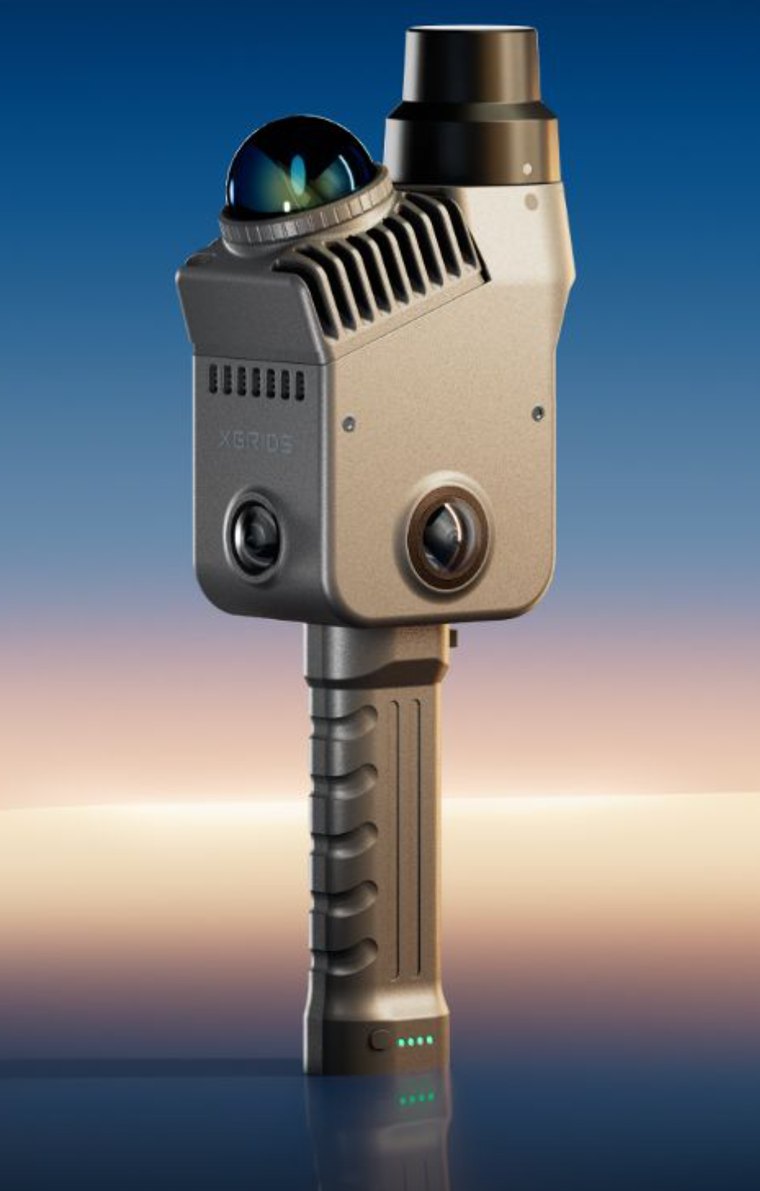
    • XGRIDS L2 Pro
    • DJI Mavic 2 Pro
  4. 4

    We process the data

    We turn the raw scan into the result you ordered and check the quality at every step.

    Technical detail

    Registration, classification, decimation, splat training and modelling — with QA at every step.

  5. 5

    You receive the results

    You get files that open in your software, or a link that opens in any browser. We stay available for as long as your project runs.

    Technical detail

    Files in your formats, hosted reviews when needed, and aftercare for as long as the project runs.

Examples you can explore

Click any tile to explore in 3D

A reality capture studio built for the EU built environment.

VOLUMON is a specialised reality-capture studio operating across the European Union.

Our pipeline combines high-end terrestrial scanners, mobile mapping, drone-mounted LiDAR and photogrammetry with custom processing.

Every deliverable is GDPR-compliant, ISO-aligned, and cross-checked against survey-grade control. We deliver in your software, on your schedule.

Architects building the reality-capture pipeline.

VOLUMON was founded by two architects who spent years working at the intersection of design, urban planning and digital construction.

Eugene Kabasin, co-founder of VOLUMON

Eugene Kabasin

Co-founder · Architect

Architect and interior designer with over a decade of international project experience.

Brings expertise in construction-site coordination, contractor management and project delivery.

yevhen@volumon.org +421 949 570 271

Matus Cloviecek, co-founder of VOLUMON

Matus Cloviecek

Co-founder · Architect & urban planner

Architect and urban planner with experience in both public administration and the private sector.

Drives VOLUMON's adoption of digital tools — drone mapping, BIM, point-cloud workflows, GIS and data-driven analysis.

matus@volumon.org +421 911 565 077

XGRIDS scanners, from a studio that scans with them.

We supply the XGRIDS handheld range.

Every configuration is quoted individually.

Request a price

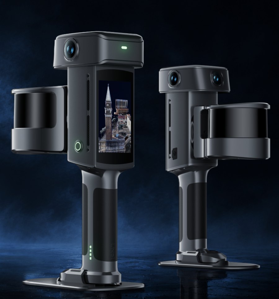
Best accuracy and colour Lixel L3

XGRIDS' flagship handheld scanner. Survey-grade RTK and three 50 MP cameras are built in, and a 4.3-inch display shows coverage and quality while you walk. One pass produces a true-colour point cloud, a mesh and a 3DGS scene.

Best for

  • Building and as-built surveys
  • Scan-to-BIM
  • Indoor and outdoor in one walk

Configurations

Model Channels Range Scan speed
L3 16/12016120 m320 000 pts/s
L3 32/12032120 m640 000 pts/s
XGRIDS Lixel L3 handheld spatial scanner

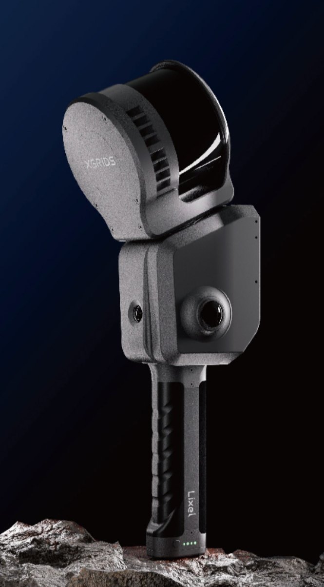
Longest range and drone mounting Lixel L2 Pro

The long-range workhorse, and the only model in the range that mounts on a drone as well as a backpack or a vehicle. The 32/300 configuration reaches 300 m, which is what large exteriors, corridors and tall buildings need. RTK is an attachable module rather than built in.

Best for

  • Campus and multi-building sites
  • Large interiors and warehouses
  • Aerial and ground capture fused together

Configurations

Model Channels Range Scan speed
L2 Pro 16/12016120 m320 000 pts/s
L2 Pro 32/12032120 m640 000 pts/s
L2 Pro 32/30032300 m640 000 pts/s

L2 Pro 32/300 — Tunnels and degraded environments; buildings up to 180 m

!

Map Fusion only works between matching models: a 16-channel scan cannot be fused with a 32-channel scan. Decide the channel count before you buy a second unit.

XGRIDS Lixel L2 Pro handheld SLAM scanner

Used unit for sale

Lixel L2 Pro 16/120, barely used and in mint condition

Ready to scan straight away, with the RTK module for georeferenced point clouds. Its scans fuse with those of other 16-channel L2 Pro units.

Included

  • Lixel L2 Pro 16/120 scanner
  • Set of 2 batteries
  • RTK module

Price

€16,000

excl. VAT

Reserve this unit

One unit available.

Lightest, with RTK built in Lixel K2

The lightweight one, at about 1.2 kg with RTK built in, so absolute coordinates come straight out of the device with no external module and no post-processing. Made for interiors and small to medium outdoor sites.

Best for

  • Interior surveys and floor plans
  • Topographic and land surveys
  • Stockpile and volume measurement
!

Plan for twice the control density of an L2 Pro job on the same site: the maximum control point interval is 50 m against the L2 Pro's 100 m.

XGRIDS Lixel K2 lightweight handheld scanner

Photoreal scenes, no measuring PortalCam

A spatial camera rather than a survey scanner. It captures photorealistic 3DGS scenes — roughly 100 m² in ten minutes — but produces no point cloud and no georeferenced coordinates. Under 900 g, handheld or on a tripod.

Best for

  • Client walkthroughs and virtual tours
  • Visual progress records
  • Marketing, web and location scouting
!

The PortalCam cannot measure. Its accuracy figures describe internal consistency inside a reconstruction, not a tolerance you can put in a contract. If the client needs numbers, the job needs an L3, an L2 Pro or a K2.

Before you order

Four things that decide most purchases.

Only the PortalCam cannot measure. If a client needs numbers they can hold you to, choose the L3, the L2 Pro or the K2.
Only the L2 Pro mounts on a drone. If you need aerial and ground data fused into one model, that is the model to buy.
The accuracy figures come from different tests. The L3's 5 mm is one sigma from an indoor test; the L2 Pro and K2 figures are RMSE. Read them as different tests, not a ranking.
RTK is built into the L3 and the K2, and is an attachable module on the L2 Pro. Budget for it separately, and check which datum your projects need.

The software side

All four devices feed the same XGRIDS software chain.

LixelStudio

Point cloud processing: registration, colourisation, control points, and export to LAS, E57, RCP and PLY.

Lixel CyberColor (LCC)

Builds the 3DGS scenes, fuses aerial and ground captures, and publishes scenes that open in a browser.

LCC for Revit

Brings 3DGS data directly into Revit, so you can model from the scene instead of switching between applications.

LixelGO · LCC Scan

The field apps that run the scan. The L3 can also be run from its own built-in display, with no phone connected.

Let's talk about your project.

Tell us about your site and what you need. We reply within one business day with a proposal and an indicative price.

What to include in your request

Enough to start

  • Where the site is
  • What you want to use the result for

Helpful if you know it

  • Approximate size of the site
  • Accuracy target
  • File formats or software you use
  • Deadline

Not sure about the technical details? Leave them out. We will define them together with you.

Coverage
European Union · 8 countries
Response
< 1 business day